The Langtang Valley Trek is a trekking route located north of Kathmandu and south of Tibet. It passes through Langtang National Park and typically takes seven or eight days of which two are spent in a jeep. My husband and I are avid trekkers, but we like to take our time and enjoy ourselves, so we opted for the eight day itinerary. I thought it was hard enough to be interesting, but not so hard that we wanted to give up. Here’s everything you need to know when planning your Langtang Valley Trek itinerary.
Langtang Valley Trek Map
Note: This map should not be used for navigational purposes. It is just meant to give an idea of the route and is not perfectly to scale. Download maps.me on your phone for an accurate offline map that is free to use.
Langtang Trek Overview
Trek Duration
This trek takes between 5 and 8 days, however I would not recommend the 5 and 6 day itinerary as it’s extremely difficult.
Langtang Valley Difficulty Level
We did an 8 day itinerary, and I found this trek to be difficult, but not so hard that we wanted to give up. We had trekkers of all different levels in our group, and everyone completed the trek and had a fantastic time.
Required Permits
A Langtang National Park permit is required for foreigners. It costs 3,000 rupees.
Trek History
The Langtang Valley has a long history. Some of the buildings along the trekking route are rumored to be 200 to 300 years old! In more recent years, it became infamous for the 2015 earthquake which hit the area hard.
Trekking began in this region around 30-35 years ago (circa 1985) when expeditions and tourists started camping in the area. Over time, the route developed and evolved into a well-worn path offering tea houses and lodging.
Best Time to do the Langtang Valley Trek
It’s best to do this trek in October or November since that is when the views are the best. March and April are the second best time since you’ll still get good views, and the flowers will be in bloom. It is extremely dangerous to do this trek in monsoon season due to landslides.
Langtang Valley Trek Altitude
Kyanjin Gompa Altitude – 3,830 m (12,565 ft)
Kyanjin Ri Altitude – 4,400 m (14,435 ft) There are a few different stopping points along the Kyanjin ridge and they have different altitudes. Some tour companies say it is 4,700 m at the highest point, our maps didn’t specify and locals said it’s 4,600 m.
Tsergo Ri Altitude – 4,984 m (16,351 ft)
Langtang Valley Trail Info
The trail for the Langtang Valley Trek is well worn. The path is easy to spot, and it’s well maintained. Locals use the route to get from village to village and they take good care of it. Some of it is dirt trails and other parts are stone that has been laid out. Some of the terrain is steep with cutback turns which make it easier to climb.
Navigating the Langtang Valley Trek
It’s easy to navigate this trek, but I do recommend new trekkers to have a guide with them. Weather can change quickly in the mountains and that can be dangerous. If it began to snow and the easy to see trail suddenly disappeared, would you be able to find your way to the next village?
Those with more experience can download maps.me for an offline map of the area. We made everyone in our group download it in case anyone got lost since we all walk at different speeds.
Packing List
I have a separate post for my packing list as it was too much to include here. Read this blog post for a list of everything I carried with me…
Langtang Valley Trekking Gear List
Trip Cost
I’ve written an entire post breaking down what we spent on the trek. You can read it here…
Langtang Valley TrekItinerary Options
Langtang Valley Trek 5 Days
I highly discourage people from following this route. It involves long days, and high jumps in altitude that will likely result in altitude sickness. This would not be a fun or relaxing itinerary. If you are in peak physical shape and are acclimated to the altitude, then you might be able to follow this itinerary. As someone who treks in Nepal several times a year, I would not even attempt this.
Day 1 – Drive from Kathmandu to Syabrubesi, then walk to Rimche (8 hours driving time, 5 hours walking time)
Day 2 – Walk from Rimche to Langtang Village (7 hours walking time)
Day 3 – Walk from Langtang Village to Kyanjin Gompa (4 hours walking time)
Day 4 – Option to climb Kyanjin Ri, then return to Rimche (9 hours walking time)
Day 5 – Walk from Rimche to Syabrubesi, then drive to Kathmandu (2.5 hours walking time, 8 hours driving time)
Langtang Valley Trek 6 Days
The six day itinerary is a little more manageable than the five day itinerary, but I still wouldn’t recommend it. Climbing Kyanjin Ri and then descending to Rimche is a long exhausting day with 9 hours of walking (not including breakfast and lunch breaks). If you are walking slowly, you may end up walking at night. This is a tough itinerary and you should only do it if you’re in great physical shape.
Day 1 –Drive from Kathmandu to Syabrubesi (8 hour drive)
Day 2 – Trek from Syabrubesi to Lama Hotel (5 hours and 30 minutes walking time)
Day 3 – Trek from Lama Hotel to Langtang Village (6 hours walking time)
Day 4 – Trek from Langtang Village to Kyanjin Gompa (3 hours and 15 minutes walking time)
Day 5 – Option to climb Kyanjin Ri, then return to Rimche (9 hours walking time)
Day 6 –Walk from Rimche to Syabrubesi, then drive to Kathmandu (2.5 hours walking time, 8 hours driving time)
Langtang Valley Trek 7 Days
The seven and eight day itineraries are the most popular for the Langtang Valley Trek. These are enjoyable options which allow you not to rush or have hours of walking with no end in sight. I find that the enjoyment level ends around five hours of walking, and I lose interest in walking any further at around six hours. That’s my own physical limits and I keep that in mind when planning. These routes allow you to finish each day without wanting to give up.
Day 1 –Drive from Kathmandu to Syabrubesi (8 hour drive)
Day 2 – Trek from Syabrubesi to Lama Hotel (5 hours and 30 minutes walking time)
Day 3 – Trek from Lama Hotel to Langtang Village (6 hours walking time)
Day 4 – Trek from Langtang Village to Kyanjin Gompa (3 hours and 15 minutes walking time)
Day 5 – Sunrise trek to Kyanjin Ri, then trek back to Lama Hotel (8 hours walking time)
Day 6 – Trek from Lama Hotel to Syabrubesi (7 hours walking time via Sherpagaon)
Day 7 – Drive from Syabrubesi to Kathmandu (8 hours driving time)
Langtang Valley Trek 8 Days
We opted for the eight day route. For one, we weren’t in a rush. Two, we had some first time trekkers with us and wanted it to be enjoyable. Three, I prefer to spend two nights in the highest village rather than try to combine a sunrise hike and descent to a lower village in the same day. Some of our group was eager to descend until they saw how beautiful Kyanjin Gompa is. After that, everyone was more than happy to have a “relaxing” day there. Mind you, we still did some difficult treks that day. If you plan to do Tsergo Ri, this is the best option as you need a full day to get there and back to Kyanjin Gompa.
Day 1 –Drive from Kathmandu to Syabrubesi (8 hour drive)
Day 2 – Trek from Syabrubesi to Lama Hotel (5 hours and 30 minutes walking time)
Day 3 – Trek from Lama Hotel to Langtang Village (6 hours walking time)
Day 4 – Trek from Langtang Village to Kyanjin Gompa (3 hours and 15 minutes walking time)
Day 5 –Sunrise trek to Kyanjin Ri or Tsergo Ri (2-9 hours walking time depending on the route you choose. We did Kyanjin Ri I, II, and III and took 5 hours including long photo breaks and a snack)
Day 6 – Trek from Kyanjin Gompa to Lama Hotel (6 hours walking time)
Day 7 – Trek from Lama Hotel to Syabrubesi (7 hours walking time via Sherpagaon)
Day 8 – Drive from Syabrubesi to Kathmandu (8 hours driving time)
Detailed Itinerary Breakdown (8 days)
Day 1 –Drive from Kathmandu to Syabrubesi
Kathmandu Altitude: 1,400 m (4,593 ft)
Syabrubesi Altitude: 1,503 m (4,931 ft)
Daily Altitude Increase: 103 m (338 ft)
Oxygen Concentration: 84% compared to 100% at sea level
Driving Time: 8 hours (with stops for lunch)
Tea house: Hotel Malla & Restaurant – This hotel was okay, I would probably try a different place the next time I’m in town. It wasn’t bad, but it wasn’t good either.
The drive from Kathmandu to Syabrubesi is long and exhausting. We hired a private vehicle which made the trip more enjoyable and a lot safer than taking the bus. Some parts of the road are in bad shape and are extremely bumpy. The road is narrow and winds around blind turns. If you get motion sickness, you’ll want to take medicine ahead of time and have a plastic bag handy. We decided not to walk this day as it’s easier just to get out of the car and chill out after such a long drive.
Day 2 –Syabrubesi to Lama Hotel
Syabrubesi Altitude: 1,503 m (4,931 ft)
Lama Hotel Altitude: 2,480 m (8,136 ft)
Daily Altitude Increase: 977 m (3,205 ft)
Oxygen Concentration: 75% compared to 100% at sea level
Walking Time: 5 hours and 30 minutes (not including lunch or tea breaks)
Distance: 10.9 km (6.8 miles) walking distance
Difficulty Level: Difficult
Tea houses: There are several tea houses on the way where you can stop for breaks.We ate lunch in Pairo at the Namaste Hotel International Bakery & Cafe. We stayed at Hotel Jungle View in Lama Hotel.
There were some minor landslides that blocked the old trekking path on our first day, so we had to follow a road for the first two hours. Usually, you can avoid the road as soon as you leave Syabrubesi.The road that leads to the trekking trail goes up and down a lot more than the old walking route, plus it was in the direct sun making it more tiring than the trail. After leaving the road, we had to cross a suspension bridge. The sides of the bridge had broken, and they were lying flat. This was an unusual thing because it gave the sensation that you were tipping over when crossing it which made it terrifying even though it wasn’t tipping over.
We ate lunch in Pairo at the Namaste Hotel International Bakery & Cafe. The food here was delicious, and the tea house had a beautiful view. Between Pairo and Bamboo, the trail is a gorgeous dirt trail weaving through the jungle. The path goes up and down a lot, but it’s not too steep. It’s an enjoyable walk with views of the river and waterfalls coming down from the hills.
After Bamboo, the path gets steeper and becomes more difficult. Although tiring, it’s a beautiful walk. Before Rimche, the trail becomes even steeper and passes over a large landslide. From here, our whole group began to struggle, even those in good physical shape. The trail is stone and dirt with some steep steps that are hard to get up. The last 20 minutes or so of the trek is a nice gentle path with few ups and downs leading to Lama Hotel. We ended up arriving in the rain when it was almost dark.
Pro Tip: Leave early. We left a little lazily at 8:20 due to having a large group at our hotel who woke us up at the crack of dawn. We were groggy in the morning and tried to sleep in. We didn’t get walking until 8:30 am which is late. We should have been on the move by 7:30 am. We took a lot of tea breaks to make sure the whole group was okay and not far behind, and lunch usually takes an hour and a half (they cook everything when you order it). So, we ended up arriving when it was starting to get dark which is not ideal or safe.
Day 3 –Lama Hotel to Langtang Village
Lama Hotel Altitude: 2,480 m (8,136 ft)
Langtang Village Altitude: 3,430 m (11,253 ft)
Daily Altitude Increase: 950 m (3,116 ft)
Oxygen Concentration: 67% compared to 100% at sea level
Walking Time: 6 hours(not including lunch or tea breaks)
Distance: 11.7 km (7.3 miles) walking distance
Difficulty Level: Difficult
Tea houses: There are tea houses on the way for breaks. We ate lunch at Lovely Guest House in Ghodatabela. We slept in Hotel Samsara in Langtang Village.
The beginning of day three starts off easy with an enjoyable walk through the woods. The path is a combination of stone and dirt. The stone was a bit slippery and uneven. It was difficult for new trekkers, but was easy for those with confidence in their footing. About 1/2 hour into the trek, there are gorgeous views of the Langtang mountain range.
We stopped for tea in Riverside. After tea, there were some steep areas that were a bit more difficult, but the last half hour of the walk was almost flat. It’s a gorgeous walk along the river. We stopped in Ghodatabela for lunch at the Lovely View Guest House. The food here was fantastic and fresh.
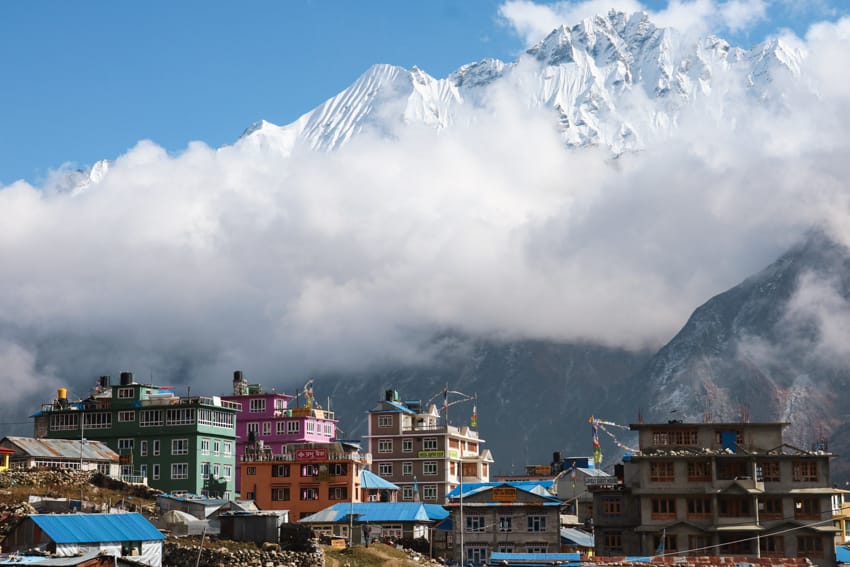
After lunch, there is one large steep uphill followed by some mild uphills. The greenery starts to fade and the valley opens up. The air starts to get a little thinner, so the small inclines feel more difficult. In this section, you’ll pass the giant landslide that took out the entire Langtang Village in 2015. Seeing it in person is hard to explain. It’s as if a giant chunk of land just disappeared. We decided to walk towards the end of the new Langtang Village to stay in Samsara Guest House which was recommended to us. The food there was surprisingly good considering how less vegetables grow at this altitude. It was one of the best meals on the entire trek.
Day 4 –Langtang Village to Kyanjin Gompa
Langtang Village Altitude: 3,430 m (11,253 ft)
Kyanjin Gompa Altitude: 3,830 m (12,565 ft)
Daily Altitude Increase: 400 m (1,312 ft)
Oxygen Concentration: 64% compared to 100% at sea level
Walking Time: 3 hours and 15 minutes(not including lunch or tea breaks)
Distance: 6.4 km (4 miles) walking distance
Difficulty Level: Moderate (due to the altitude)
Tea houses: There are plenty of tea houses to stop at along the way. We ate lunch in Kyanjin Ri at our hotel. We stayed at Panorama View which had clean rooms, an attached bathroom, and hot water for showers. We also visited and ate atNayakhanga Peak Guest House which was equally as nice and had great food.
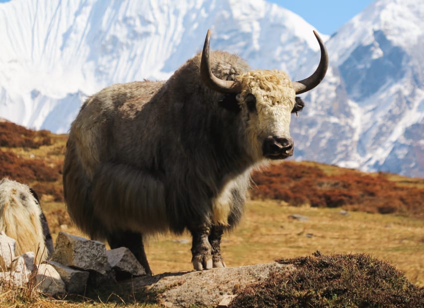
Day four is a gorgeous day with incredible views of the Langtang Valley. The path here has some mild inclines which feel difficult due to the altitude and thin air. Overall, I’d consider this an easy day if it were easier to breathe. We moved slowly to avoid altitude sickness and took tons of breaks to watch the yak roaming free and to take photos. There were lots of baby yaks when we passed through, so it was fun to watch them playing with each other. This is definitely the most enjoyable day of the trek.If you still have energy when you arrive, you can go see the Kyanjin Yak Cheese Factory and the 200-300 year old Gompa.
Day 5 –Sunrise trek to Kyanjin Ri (or Tsergo Ri)
Kyanjin Gompa Altitude: 3,830 m (12,565 ft)
Kyanjin Ri Altitude: 4,400 m (14,435 ft) – 4,700 m (15,419 ft) depending on where you stand on the ridge.
Tsergo Ri Altitude: 4,984 m (16,351 ft)
Daily Altitude Increase: You sleep at the same altitude as the night before.
Oxygen Concentration: 55% (at Tsergo Ri) compared to 100% at sea level
Walking Time: 5 hours walking time for Kyanjin Ri I, II, and III with breaks. 9 hours walking time for Tsergo Ri with breaks.
Difficulty Level: Very difficult
Tea house: There are no tea houses on the way to Kyanjin Ri or Tsergo Ri, so it’s best to pack whatever food you need. For Kyanjin Ri, we packed a chapati and slices of yak cheese for a snack. Those going to Tsergo Ri may want to pack a larger lunch.
The trek to Kyanjin Ri is difficult due to the steepness of the hill and the high altitude. With the air being thin, it’s extremely hard to breathe and catch your breath. There were times I needed to stop and sit because my heart was pounding so much. It’s important to move slowly and try not to get out of breath. A slow steady pace is best. It took us a little over two hours (walking time) to Kyanjin Ri III, then down to Kyanjin Ri II, down toKyanjin Ri I, and back to the tea house in Kyanjin. However, we took tons of breaks for photos and sat down and ate our snack so we took about five hours total. We probably stopped at each of the viewpoints for a half hour. It was a beautiful warm day and we planned to stay in Kyanjin Ri that night so there was no rush.
Pro Tip: You should try to be back to the tea house by 11am because the valley is very windy and that can make walking even harder (and dangerous in some areas). We came down around 11:00 am and the wind was hitting my face so hard that it was painful. I do recommend trekking poles as the way down is very steep and slippery. If you have knee or ankle problems, wear a knee/ankle brace.
Later in the day, we walked to “7 Lakes” which is more like “7 Ponds.” A few of our group didn’t make it to Kyanjin Ri and wanted to do a day trek. This is an easy route with very few hills. 7 Lakes took us about 2 hours round trip. If you go in the morning when there’s no wind, you can get some nice photos of the mountains reflecting in the water.
Day 6 –Kyanjin Gompa to Lama Hotel
Kyanjin Gompa Altitude: 3,830 m (12,565 ft)
Lama Hotel Altitude: 2,480 m (8,136 ft)
Daily Altitude Increase: – 1,350m ( -4,429 ft)
Oxygen Concentration: 75% compared to 100% at sea level
Walking Time: 6 hours(not including lunch or tea breaks)
Distance: 17.7 km (11 miles) walking distance
Difficulty Level: Easy – Moderate
Tea house: There are plenty of tea houses to stop in for breaks. We ate lunch in Ghodatable at Lovely Guest House. We slept in Hotel Jungle View in Lama Hotel.
Day six was surprisingly easy. We were told it was a long walk and would take 7-8 hours. Since we’d been walking slowly the whole trip, we decided to cut down on breaks and move a little quicker to avoid arriving in the dark. During the flat sections, we had a nice power walk going which was easy to maintain. In the steep sections, we took our time and went slow. The walk ended up being really enjoyable. We arrived at Lama Hotel just before 4pm and all of us agreed it was a much easier walk than we had mentally prepared for. My knees hurt a little by the end of the day, but overall it wasn’t too bad. We ended up making it in six hours.
Day 7 –Lama Hotel to Syabrubesi (via Sherpagaon)
Lama Hotel Altitude: 2,480 m (8,136 ft)
Syabrubesi Altitude: 1,503 m (4,931 ft)
Daily Altitude Increase: – 977 m ( -3,205 ft)
Oxygen Concentration: 84% compared to 100% at sea level
Walking Time: 7 hours(not including lunch or tea breaks) via Sherpagoan
Distance: 11.26 km (7.9 miles) walking distance
Difficulty Level: Difficult
Tea house: There are teahouses in Sherpagoan and Khangjim for tea breaks. We ate lunch in Super View Guest House and the food was phenomenal. It was the best food we’d had in days. We ended up staying inKhangjim instead of Syabrubesi. We stayed at Mother’s Home.
We took off late due to a misunderstanding about when we wanted breakfast. We didn’t hit the trail till 9:40am which was more than an hour behind schedule. So, we did a trail run to Rimche. After Rimche, we decided to take the route that goes through Sherpagoan. The route was beautiful, but it was tough. There were steep up and down hills which we weren’t expecting. It also ran along a cliff and would not be a good choice for those afraid of heights. If it weren’t for a giant blister on the bottom of my foot, I would have enjoyed this section as it was much prettier than the route we walked on day two.
We had lunch in Sherpagoan atSuper View Guest House. The food was amazing and it was the first time we got so many vegetables since we started the trek. After lunch, it was a steep downhill all the way to the village ofKhangjim. Walking through the villages was gorgeous. We were surrounded by wheat fields set in front of giant green rolling hills. The village had old stone buildings lining the pathways. Because of the late start and my blister, we didn’t arrive till 4:15 pm.
Day seven was difficult for me because of the massive blister on the bottom of my toes. Going uphill was manageable, but the steep downhills caused me a lot of pain. I ended up hobbling into the village ofKhangjim almost in tears from walking on it for seven hours. So, we opted to stay there the night instead of walking another hour and a half to Syabrubesi. We arranged for a jeep to pick us up which cost more, and the road was a little scary, so I’d recommend walking if you can.
Day 8 – Drive from Syabrubesi to Kathmandu
Syabrubesi Altitude: 1,503 m (4,931 ft)
Kathmandu Altitude: 1,400 m (4,593 ft)
Daily Altitude Increase: – 103 m ( -337 ft)
Oxygen Concentration: 85% compared to 100% at sea level
Driving Time: 8 hours (with stops for lunch)
We ended up hiring a jeep fromKhangjim which I wouldn’t recommend. The road was bad and the brakes on our jeep broke on the way up. We had to wait hours for a temporary fix which, no joke, involved a condom. Then it was a slow ride down to Syabrubesi where we had to wait another two hours for a proper replacement part to be put in (because let’s be honest, a condom is not an ideal car part). After all that, we didn’t get on the road till after 1pm. We ended up driving back to Kathmandu in the dark which is not as safe since the roads are not well paved in sections. It was a long and tiring day and we didn’t get home till almost 9:00 pm.
Langtang Valley Village Guides
You might also like…
Michelle Della Giovanna
Writer at Full Time Explorer
I’m just your average New Yorker who quit her job in the fashion industry to explore the world. Come find out what it’s like to trade in five-inch heels for squat toilets.
I happened to land on your blog and find it very helpful. Your easy & engaging style of writing makes it joyful to read it. And all the excitement and pain you felt during your treks comes through that!
I’m planning to do a solo Langtang Valley trek in March-April, and will be visiting this blog multiple times. Thanks for writing and maintaining this site.
Thank you so much! Have a wonderful trip. Langtang is a gorgeous area… you’ll love it!
Hello! Do you recommend hiring a porter and guide online or when I land? I am planning a trip April 2024
Hello MJ,
Since it’s peak season in April, I would personally do it a month or two in advance. I’ve found that in peak season, if you wait till the last minute to book, you will find someone, but it’s likely they aren’t as experienced or there might be a reason they haven’t been booked yet.
Greetings! I read in great detail your blog posts about trekking in the Langtang Valley. I just booked a very last minute trip (leave in four days), and am feverishly searching for guide recommendations. Your posts were so well written and thoughtful I though you may have some tips regarding booking at guide at the last minute. I’d prefer to hire a private guide, but can of course join a group if needed. I imagine a group would cut down on potential jeep costs. Many thanks!!!
Hello!
I sent you an email, but wanted to write it here as well. We recommend Karma who is a guide who lives in the Langtang Valley and knows the area well. His phone number is +977 9808753202. Have an amazing trip!