The Tsho Rolpa Trek seems to be a mystery when you try to find information online. While this trek is one of the best kept secrets in Nepal, it’s also one of the easiest treks to navigate. The Swiss Embassy is about to complete the trekking trails on this route, and they are the nicest trekking trails I’ve seen in Nepal. They’ve constructed even stairs and well-manicured trails that are so easy to navigate that it would be impossible to get lost. Therefore, this post won’t be full of “turn left at the tree then right at the monastery.” Instead, it’s meant to give everyone some info on what to expect each day and in each town. We honestly didn’t even know if we’d find teahouses before we left because there was so little info listed online.
Tsho Rolpa Trek Overview
Duration: 7 to 9 days
This trek can be done in 7 days if you take transportation there and back on hiking days. We chose to travel to and from the starting point on days when we didn’t hike, so it took 9 days.
Difficulty Level: Moderate/Difficult
Highest Altitude: 4,558 m (14,954 ft)
Permits: GCAP costs 3,000 rupees
Tsho Rolpa Trek Route Map
Best Time of Year to Visit Tsho Rolpa
October, November, April, and May are the best times to complete the Tsho Rolpa trek. Since the trek isn’t popular yet, many teahouses close in the off-season. Teahouse owners told us that during monsoon they stay put in the village because the streams that look small in May become raging rivers and people have died trying to cross them. In the winter, many of the locals go down to areas around Kathmandu and close their teahouses for a few months.
Things to Know in Advance
The Tsho Rolpa trek is almost entirely vegetarian. From Kyalche on, it is forbidden to kill animals. If you are a meat eater, this may not be the trek for you. If you are vegetarian or vegan, this is an ideal place to go trekking in Nepal as the animals in the area are only used for their poop which is used to fuel stoves (instead of wood) or as fertilizer for growing potatoes.
Gaurishankar Conservation Area
There’s a 3,000 rupee entrance fee for the Gaurishankar Conservation Area, however you don’t currently need a TIMS cards to do this trek. You can buy the permit at the Nepal Tourism Board office in Kathmandu.
Tsho Rolpa Itinerary Daily Breakdown
Day 1: Singati Bazaar to Chhetchhet to Simigaun
Altitude: Chhetchhet 1,398 m (4,586 ft) to Simigaun 2,000 m (6,561 ft)
Altitude Increase: 602 m (1,975 ft)
Walking Time: 2.25 hours (the jeep from Singati to Chhetchhet is an additional 1 hour)
Oxygen Concentration: 80% (compared to 100% at sea level)
Number of teahouses in Simigaun: 3
We stayed at: Sherpa Hotel
Price of room: 500 rupees (price in 2021)
Price of vegetable dal baht: 300 rupees (price in 2021)
WiFi: No
Electricity: Yes, with outlets to charge in each room
Toilet Situation: Outhouse / squat toilet
Showers: Buckets of hot water available for a fee
NTC Service: Limited Cell Service
We decided to do a hike in the area prior to the Tsho Rolpa trek, so I haven’t included travel days in the itinerary. If you take the 6am bus from Kathmandu to Singati Bazaar, you’ll arrive around 2pm. From here, it’s another hour to Chhetchhet. If you begin the hike the same day, you can arrive to Simigaun by 5pm or 6pm. We spent a night at a friend’s house in Singati and went to Simigaun the following morning. The hotels in Singati aren’t very comfortable, so it might be best to begin the trek right away if you have the energy.
We hired a private jeep to take us from Singati to Chhetchhet in the morning although local buses stop there as well. Chhetchhet is a small highway town with no teahouses. We had a snack and tea there before taking on the steep climb to Simigaun. The shop owner in Chhetchhet told us that she only sees about 4 foreign trekkers a day during peak seasons, but she sees quite a few Nepali trekkers doing this route.
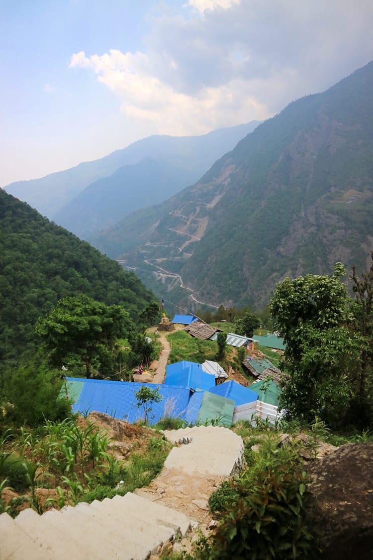
The path to Simigaun is straight up stairs. The Empire State Building has 1,576 steps. I’m guessing if you counted, this would be close in comparison or it might even be more steps. Luckily, a near perfect staircase was recently built. The even concrete steps make the climb bearable. We took it nice and slow as not to get out of breath and manage to reach the top in 2 hours. On the way we see a man carrying a telephone pole on his back. It weighs 135 kg (300 lbs) and he’ll receive about $90 USD for delivering it to Simigaun. I can’t help but laugh at the idea of weightlifting competitions where someone lifts this much weight for a mere 5 seconds and gets a prize.
You can read my Simigaun Village Guide for more info!
Day 2: Simigaun to Dongang
Altitude: Simigaun 2,000 m (6,561 ft) to Dongang 2,790m (9,153 ft)
Altitude Increase: 790 m (2,591 ft)
Walking Time: 8.5 hours including 2 tea breaks and a lunch break in Surmuche.
Oxygen Concentration: 72% (compared to 100% at sea level)
Number of teahouses in Dongang: 2 (but only one was open)
We stayed at: It currently has no name, but it’s the one by the river
Price of room: 500 rupees (price in 2021)
Price of vegetable dal baht: 400 rupees (price in 2021)
WiFi: No
Electricity: No
Toilet Situation: Outhouse / squat toilet
Showers: No
NTC Cell Service: No
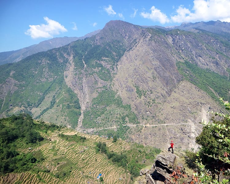
After leaving Simigaun, the trail is moderate with only slight ascents and descents. We stop for tea in the village of Uttise. This village seems to be just one small tea shop as far as I can tell. A little over an hour after Uttise is Surmuche. It’s a steady incline to reach Surmuche and we arrive fairly tired. We stop to have lunch there at the only teahouse in town. It’s possible to spend a night here, but we decide to move on as there’s two more villages ahead that we can stop at for the night. After lunch, it’s another hour to Kyalche which has a really nice teahouse. We stop there for some tea and a break but decide to continue on to Dongang to make the next day easier.
The route from Kyalche to Dongang is easy. It goes down in altitude with just a few ups and downs on the way. The village of Dongang is just two teahouses. One is closed and looks like it’s been closed for a while. On the way, we see an incredible eagle flying on the other side of the river. It sits perched there while we admire how big it is from afar. Overall, it’s a long day, but we stopped a lot for photos, breaks, and tea. It could definitely be done quicker or you could split it into two days.
You can read my Dongang Village Guide more info!
Day 3: Dongang to Beding
Altitude: Dongang 2,790m (9,153 ft) to Beding 3,721 m (12,208 ft)
Altitude Increase: 931 m (3,054 ft)
Walking Time: 5.5 hours including a lunch break in Thangding
Oxygen Concentration: 65% (compared to 100% at sea level)
Number of teahouses in Beding: At least 3 (possibly more)
We stayed at: Gaurishankar Himalayan Hotel & Lodge
Price of room: 500 rupees (price in 2021)
Price of vegetable dal baht: 500 rupees (price in 2021)
WiFi: No
Electricity: Yes
Toilet Situation: Western toilet
Showers: Buckets of hot water available for a fee
NTC Service: Limited Cell Service
We went on this hike at the end of May which is apparently off-season due to the lack of tourists on this trail. Most tourists go around October, so a few of the teashops were closed. In the morning, we walked about 2 hours before reaching Thangding where the teahouse was closed. We knew this might be an issue, so we ordered some hard-boiled eggs and chapatis to bring with us. Unlike other trekking trails in the country, this one has no shops. It’s important to bring snacks from home or Kathmandu, and plan a packed lunch before leaving your teahouse each day.
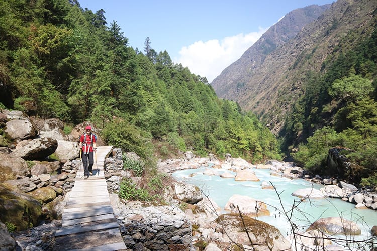
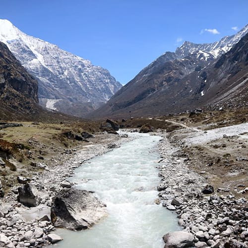
The walk to Thangding is gorgeous. We pass by several waterfalls and walk along the river (Rowaling Khola) almost the entire way. It seems that there is a mountain view in almost every direction, but the highlight today is seeing Gaurishankar which is 7,134 m (23,405 ft).
Shortly after leaving Thangding, we pass a holy temple. Locals tell us that a cow gave birth to a god here. Villagers come to the temple to ask Lord Shiva for his blessing before leaving on a journey. That way they’ll have safe travels. The signs nearby say that it’s forbidden to smoke or drink alcohol in the area. If you do, you’ll receive a fine and face Lord Shiva’s wrath.
From here, we end up in a mist of cold fog. After the temple is an old yak herder village that looks abandoned. You can see a large landslide from the 2015 earthquake and several of the old houses have caved in. With the fog, the area feels eerie and ominous. We try to pass through quickly, but the altitude starts to set in. Around 3,500m you can start to feel the effects, and it gets a little harder to breathe.
Beding is a surprisingly large village with two monasteries. There’s an old monastery set into the rocks that was closed after the earthquake. Despite that, you can still hike up there. When we arrived, it was cold and raining, but later that day we all suffered a minor case of altitude sickness. If you can, it’s best to hike up to the monastery and then back down before dinner. Going higher than you sleep is always smart for acclimatizing properly. If Thangding was open, we would have spent a night there to split up the journey. I’d also recommend having Diamox (altitude sickness medicine) with you in case you need it.
You can read my Beding Village Guide for more info!
Day 4: Beding to Na
Altitude: Beding 3,721 m (12,208 ft) to Na 3,943 m (12,936 ft)
Altitude Increase: 222 m (728 ft)
Walking Time: 5.5 hours with snack breaks
Oxygen Concentration: 63% (compared to 100% at sea level)
Number of teahouses in Na: 3 but only one was open
We stayed at: Na View Point Hotel
Price of room: 500 rupees (price in 2021)
Price of vegetable dal baht: 600 rupees (price in 2021)
WiFi: No
Electricity: Limited Solar Power
Toilet Situation: Outhouse / squat toilet
Showers: No
NTC Cell Service: No
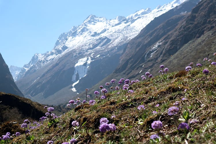
The walk from Beding to Na is incredibly beautiful. We walked super slow and stopped regularly for snacks that we brought with us from home. Plus, we bought hard-boiled eggs in Beding to take with us. There’s several amazing waterfalls and another monastery set into the side of the mountain.
The best part of this day is seeing all of the yak herds, cows, and sheep roaming freely through the valley. Once we arrived in Na, we asked some of the locals about the animals. About 10 years ago Guru Rinpoche made it illegal to kill animals above Dongang. Previously, tourists would come camping and demand meat. Locals would kill the animals for business, but it’s a Buddhist area and Guru Rinpoche felt it was disrespectful. Five years later, he rescued 108 yaks and brought them to the area to roam free. Seeing the animals free and wild was pretty cool, not to mention that there were about a dozen baby yak which were beyond cute. One ran at me like a little puppy dog, and it was so sweet.
Note: These yaks are wild, so it’s best not to approach them. Take photos from afar and don’t disturb them.
You can read my Na Village Guide for more info or check out my post on the Yak Sanctuary!
Day 5: Na to Tsho Rolpa to Beding
Altitude: Na 3,943 m (12,936 ft) to Tsho Rolpa 4,558 m (14,954 ft) to Beding 3,721 m (12,208 ft)
Altitude Increase: 615 m (2,017 ft)
Walking Time: 2 hours up to Tsho Rolpa Lake and 3.5 hours down to Beding
Oxygen Concentration: 58% (compared to 100% at sea level)
We stayed at: Gaurishankar Himalayan Hotel & Lodge
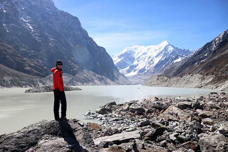
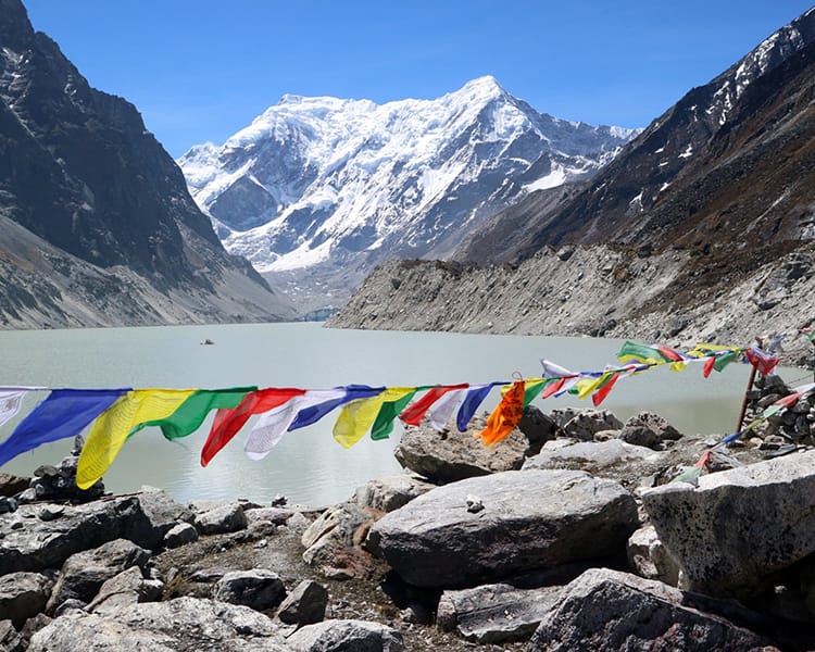
The hike from Na to Tsho Rolpa Lake isn’t very long, but it’s difficult. Signs and locals say it takes about 3.5 hours, but even at a slow pace we made it in 2 hours. The path starts out super easy and flat, but right before the lake it turns into a steep staircase going straight up. Usually at this altitude, the trails are a series of hairpin turns and zigzags. Since stairs have been put in place, there is no gradual increase. Just up up up. After reaching the top, we spend an hour enjoying the view. You can walk around parts of the rim of the lake without much hassle.
The way down doesn’t take too long. We told the women running the teahouse in Na that we would be back for lunch, so they have it prepared when we arrive. If you have the time you can add a day to see Dudh Lake (Milk Lake). The path there isn’t well worn, and it’s another 3 hour hike up from Na. We were exhausted and decided to head back down.
Day 6: Beding to Kyalche
Altitude: Beding 3,721 m (12,208 ft) to Kyalche 2,810 m (9,219 ft)
Walking Time: 6 hours including a tea break and a lunch break
Oxygen Concentration: 72% (compared to 100% at sea level)
Number of teahouses: 1
We stayed at: Kyalche Lodge
Price of room: 500 rupees (price in 2021)
Price of vegetable dal baht: 450 rupees (price in 2021)
WiFi: No
Electricity: Limited Solar Power
Toilet Situation: Outhouse / squat toilet (but very clean)
Showers: They have an open outdoor area with hot water. You can wash your hair with your clothes on.
NTC Cell Service: No
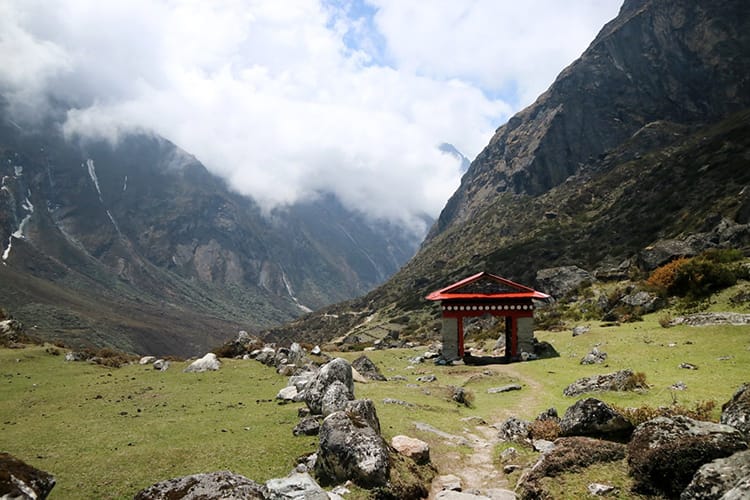
Some people walk all the way to Simigaun to cut a day out of the Tsho Rolpa trek. We were tired, so we stopped in Kyalche. Kyalche was my favorite place we stayed during the entire trek. The teahouse was super clean including the squat toilet bathroom which looks like a sauna inside. They also had amazing blankets. The young girl who runs it can cook pretty decent Italian food. We had a mushroom macaroni which was made with dried mushroom and Italian sauce. I almost never order western food while trekking because tomato sauce is often just ketchup. I was very surprised with how great this dish tasted.
You can read my Kyalche Village Guide for more info!
Day 7: Kyalche to Chhetchhet to Singati Bazaar
Altitude: Kyalche 2,810 m (9,219 ft) to Chhetchhet 1,398 m (4,586 ft)
Walking Time: 3 hours with a tea break
Jeep from Chhetchhet to Singati: 1 hour
Number of hotels: At least 5, but they are not very clean
We stayed at: Chinari Hotel
Price of room: 1000 rupees (price in 2021)
WiFi: Yes
Electricity: Yes, but it cuts in and out a lot
Toilet Situation: Western toilet / private bathroom
Showers: Cold water in room, or hot water in shared bathroom
NTC Cell Service: Yes
Ncell Service: Yes
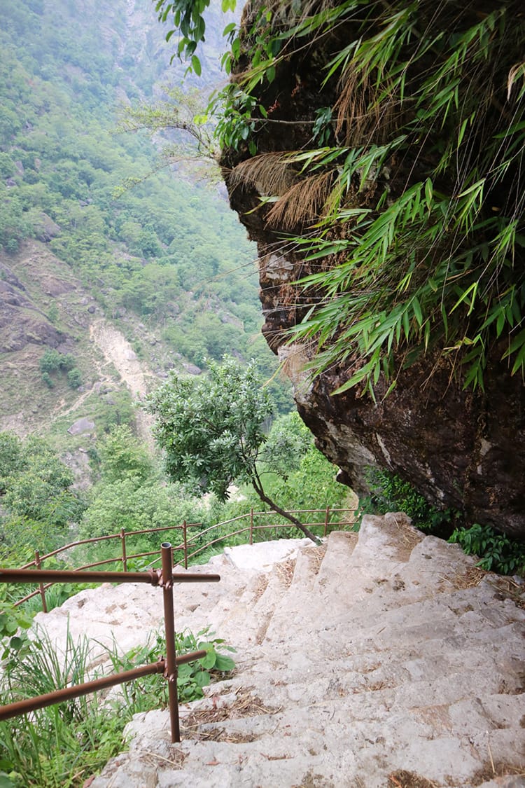
The walk down from Kyalche is a bit rough. Going down all the stairs is worse than walking up. Our knees were starting to hurt by the time we reached Chhetchhet. We had lunch in Simigaun on the way down. While waiting for lunch, we called that same jeep that dropped us off and arranged for them to meet us at the bottom of the hill so that we wouldn’t have to wait for them. If you leave early enough, you can get back in time to catch a bus back to Kathmandu, but it will be a long day of travel as the bus takes about 8 hours.
If you have a private vehicle hired to take you back to Kathmandu, I’d recommend going straight from here (or stopping in Charikot on the way back). Staying in Singati was a struggle for me. The hotels are not very clean. The Chinari Hotel was the best one we could find in town. To split up the long bus ride, we stopped in Charikot the following day and checked into the Charikot Panorama Resort which was a much needed break after roughing it for a week.
Have any questions about the Tsho Rolpa Trek Itinerary? Drop a comment and I’ll be happy to answer!
Looking for more on Tsho Rolpa? Check out my Tsho Rolpa Lake Trek Budget and Tsho Rolpa Packing List
You might also like…
Michelle Della Giovanna
Writer at Full Time Explorer
I’m just your average New Yorker who quit her job in the fashion industry to explore the world. Come find out what it’s like to trade in five-inch heels for squat toilets.
In theory, the area above Beding is restricted, we are not allowed to trek towards Na and above without a Restricted Area Permit, which implies going with an agency and guide. This has been confirmed to me by the official at the Nepal Tourist Board.
It seems there isn’t anyone checking the access on the ground, but beware trekkers could be arrested based on the information on your website.
Hello, I spoke with the officials at the Nepal Tourism Board as well and got all the required permits before going. I believe the special permit is for those who plan to cross the Tashi Lapsta Pass. I actually trekked the Tsho Rolpa route at the same time as the Nepali representative from the Swiss Embassy and no special permit was required above Beding. They will only be in trouble if they do the pass which isn’t marked, requires camping, and is dangerous without a guide.
Very nice to read your trek in the Rolwaling valley and your love for Nepal.
I come in Nepal since 1978 for trekkiing, hiking and climbing almost every year.
When did you do this trek? Was this in September 2019?
Never visited that area. I planned to climb Ramdung and cross the pass to Thame, bu due to a lung problem I had to skip that.
Hello Tom, We went in 2019 but friends of mine went in 2021 using my itinerary and all of the information was still up to date as not much changed during lockdowns. Rolwaling is a lovely area. I hope you are able to visit one day!
Namaste!
I was referred to your site by Kim Bannister and many thanks for the detailed itinerary – plan to do this route with a group in November this year – perhaps the tea houses may have improved since you last went! Cheers and great blog..
Thank you so much! I think they may have built a few more teahouses in the last few years, so there may be more options to choose from. Have an amazing trip! This trek is really beautiful.